← Independent product2025 — Present
Campo Bueno
Better context beforebuying or selling land.
- Role
- Independent product
- Dates
- 2025 — Present
- Field
- Geospatial / Agriculture
Context
Where the product lives
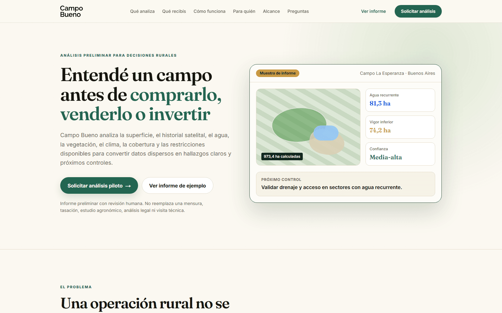
Rural property decisions are made with very little shared context. Buyers, sellers and advisors rely on visits, word of mouth and scattered documents. Campo Bueno is my independent product exploring how public satellite and geospatial data can fill that gap.
Problem
What makes it hard
The data exists, but it is fragmented, technical and hard to read. Turning imagery, indices, climate series and land history into a report a non-specialist can trust is a product problem as much as a data problem.
Work
What I worked on
- Product definition, positioning and landing page.
- Geospatial pipeline on Google Earth Engine: boundaries, vegetation indices, deforestation and climate signals.
- Interactive map and report interface in Next.js and TypeScript.
- Data model and infrastructure on PostgreSQL and cloud services.
Decisions
Technical decisions
- Start from the report the user needs, then decide which analyses are worth computing.
- Precompute heavy analyses and keep the interactive layer light.
- Show confidence and limitations explicitly instead of overstating what satellite data can prove.
Product
Product considerations
- A preliminary analysis should say clearly what it is not: not a survey, not a legal opinion.
- Every signal needs a plain-language explanation next to it.
- The output must be presentable to a third party, not just readable by the person who ordered it.
Stack
Technologies
- Next.js
- TypeScript
- Satellite imagery
- Google Earth Engine
- NDVI
- Deforestation analysis
- Climate data
- Interactive maps
- PostgreSQL
- Cloud infrastructure
Selected visuals
Illustrative
Outcome
What changed
A live product with a public landing page and a working analysis pipeline. Ongoing development as an independent project.